Skip to content
BETA

Menu

Account

Language

Practical Thailand guides

Practical Thailand guides

Step-by-step guidance for planning a trip, a longer stay or a move to Thailand.

  • Travel

    At Thailand's western edge, a Mon wooden bridge, a temple drowned by a dam, and a refugee community make up one of the country's least-known corners.

    3 min read

    Sangkhlaburi: the wooden bridge, the sunken temple, and Thailand's forgotten Myanmar border

    Travel

    Sangkhlaburi: the wooden bridge, the sunken temple, and Thailand's forgotten Myanmar border

    Last reviewed: 18 July 2026 Written by Ricardo Santos

    Photo by Laura Paredis / Pexels

    At Thailand's western edge, a Mon wooden bridge, a temple drowned by a dam, and a refugee community make up one of the country's least-known corners.

    The end of the road, literally

    Sangkhlaburi sits at the far end of Route 323, less than ten kilometres from the Myanmar border, in Kanchanaburi province — roughly five to six hours' drive from Bangkok, which is exactly why the town remains largely absent from organised tours that stop at the much closer River Kwai Bridge. It isn't a transit stop or a logical waypoint on a standard route: you come to Sangkhlaburi on purpose, not in passing.

    Thailand's longest wooden bridge

    Saphan Mon, usually just called the "wooden bridge" (Mon Bridge), stretches roughly 400 metres across the Vajiralongkorn reservoir, connecting the Thai town to a district populated mostly by Mon refugees, a Burmese ethnic minority settled here since the 1980s. Built without a single metal nail using traditional methods, the bridge is best crossed at dawn to watch Mon monks receive morning alms, a daily ritual that plays out directly on the wooden planks, a world away from the tourist protocol at the River Kwai Bridge.

    Wat Sam Prasop, the temple the dam drowned

    Below the bridge, when the reservoir drops low enough in dry season (usually March to May), the ruins of Wat Sam Prasop emerge from the water: this Buddhist temple was partly submerged when the Vajiralongkorn Dam was built in the 1980s, and its ghostly silhouette — reachable by small boat, and occasionally on foot when the water recedes completely — makes it one of the most unusual and least-photographed sites in the country. The rest of the year only the stupa's tip breaks the surface, a quiet, permanent reminder of what lies beneath.

    A community at the border of three cultures

    Sangkhlaburi holds a mixed population of Thai, Mon, and Karen residents alongside a significant Burmese refugee community, which shows up concretely in markets selling hand-woven Mon textiles, cooking influenced by neighbouring Myanmar, and temples blending architectural styles. The morning market near the town centre is worth the visit just to see this cultural mix play out with no particular tourist staging — it's an ordinary neighbourhood market that happens to be extraordinarily diverse.

    Access, season, and pace

    From Bangkok, the direct drive by car or rented minibus takes five to six hours; public buses from Kanchanaburi (itself about three hours from Bangkok) take longer but remain the cheapest option. Dry season (November to April) brings the best conditions, and March to May offers a real chance of seeing the sunken temple emerge; monsoon (June to October) raises water levels again and can make some back roads difficult. Two nights are usually enough for the dawn bridge crossing, the sunken temple depending on season, the morning market, and a boat ride on the reservoir — a deliberately slow pace that matches the place itself.

    Sources

  • Travel

    Bangkok's only hill is entirely artificial — built from the rubble of a chedi that collapsed under its own weight, then crowned with a relic and 318 steps of bells.

    3 min read

    Bangkok: Golden Mount and the historic-city skyline

    Travel

    Bangkok: Golden Mount and the historic-city skyline

    Last reviewed: 16 July 2026 Written by Ricardo Santos

    Zaonar Saizainalin / Pexels

    Bangkok's only hill is entirely artificial — built from the rubble of a chedi that collapsed under its own weight, then crowned with a relic and 318 steps of bells.

    A monument built from failure

    Wat Saket dates to the Ayutthaya era, when it was known simply as Wat Sakae, but the hill that made it famous didn't exist yet. In the early 1800s, King Rama III ordered a giant chedi built on the temple grounds — an ambitious project that outgrew Bangkok's notoriously soft, waterlogged soil. The structure collapsed mid-construction, and rather than clear the debris, the court left it in place. Over decades the rubble mound grew, settled, and became the only real elevation in a city built on a floodplain: an accidental hill made of a failed monument's own ruins.

    From rubble pile to relic shrine

    Rama IV reinforced the mound with timber piles so it would stop slumping, but it was Rama V who transformed it into what stands today, sometime in the late 19th century. British colonial administrators in India gifted Siam a Buddha relic, and rather than house it in an existing temple, the king chose to finish what his predecessors started: a gilded chedi was finally completed atop the reinforced hill, with the relic sealed inside. What began as an engineering failure ended as one of the most visited pilgrimage points in the old city — Phu Khao Thong, the Golden Mount.

    Climbing 318 steps of bells

    The ascent is part of the experience, not an obstacle to it. A spiral staircase — sources count between roughly 300 and 344 steps depending on where the count starts — winds up past a collection of bells and gongs that visitors are invited to strike on the way, a Thai Buddhist tradition believed to spread merit with each ring. At the top, a circular terrace wraps around the chedi's base and delivers one of the only unobstructed panoramas over Rattanakosin, the old royal island: temple spires, low tiled rooftops, and the Chao Phraya curling past in the distance, with none of the high-rise skyline that dominates the view from modern Bangkok viewpoints.

    What the climb asks of you

    Unlike the Grand Palace, there's no ticket booth crowd and no long queue, which makes it an easy add-on to a temple-cluster day rather than a destination requiring its own half-day. But it is a genuine physical climb in tropical heat and humidity, and shoes come off before entering the sanctuary itself, so factor in bare feet on stone and a shawl if shoulders need covering — rentable on-site for roughly 50 THB.

    Practical planning

    Wat Saket opens daily from around 7:30am to 5:30pm. Entry for foreign visitors is 100 THB; Thai nationals enter free. Dress modestly — knees and shoulders covered — and expect to remove shoes at the sanctuary level near the summit. The temple sits near Phan Fa Lilat, reachable by khlong canal boat to the Phan Fa Lilat pier, by public bus, or by taxi; it pairs naturally with a walk through the nearby Golden Mount fair grounds and Loha Prasat's distinctive metal spires. Allow 45 to 60 minutes including the full climb and a slow look at the view.

    Source: Tourism Authority of Thailand, tourismthailand.org

    Sources

  • Travel

    Thailand's highest peak is also, literally, a king's grave. A practical framework for visiting its summit, twin pagodas and closed-season trail without turning the mountain into a box to tick.

    3 min read

    Chiang Mai: planning a responsible Doi Inthanon day

    Travel

    Chiang Mai: planning a responsible Doi Inthanon day

    Last reviewed: 16 July 2026 Written by Ricardo Santos

    Frank van Dijk / Pexels

    Thailand's highest peak is also, literally, a king's grave. A practical framework for visiting its summit, twin pagodas and closed-season trail without turning the mountain into a box to tick.

    The mountain named after its own grave

    At 2,565 metres, Doi Inthanon is mainland Thailand's highest point, but its modern name is a relatively recent tribute. It was once called Doi Luang Ang Ka, "crow's pond mountain," until it was renamed for King Inthawichayanon, Chiang Mai's seventh ruler, who reigned from 1870 to 1897 and pushed early forest-conservation policy for the region's northern highlands. British surveyor James McCarthy formalized the name "Inthanon" on official maps as tribute. What makes the story more than a naming footnote: after the king's death in 1897, his daughter, Princess Dara Rasmi, had his ashes interred in a small stupa near the true summit. The "Roof of Thailand" is, quite literally, also a royal tomb — most visitors who tick off the summit marker never learn they're standing beside a grave.

    Twin pagodas with a different story entirely

    A ridge lower down the mountain holds Phra Mahathat Naphamethanidon and Naphaphonphisai, two large pagodas built in 1987 and 1992 to mark the 60th birthdays of King Bhumibol and Queen Sirikit respectively. Unlike the centuries-old temples of Chiang Mai's Old City, these are modern royal monuments, and their setting is the point: a hanging garden walkway threads between them through cloud forest, with views that shift from bright sun to drifting mist within minutes depending on the hour. They read as a deliberate counterpoint to the summit's quiet grave — one site built to be seen, the other built to be found.

    Why Kew Mae Pan needs a guide

    The park's ecological centerpiece is the Kew Mae Pan nature trail, a loop through high-altitude cloud forest and grassland considered one of the most sensitive habitats in the park. It closes entirely from June through October each year to let the ecosystem recover from dry-season foot traffic, and even in open months a local guide is mandatory — arranged on-site for roughly 200-220 THB per group, not optional or skippable. The rule exists because the trail's soil and rare montane plant species erode quickly under unsupervised, off-boardwalk traffic; staying on the marked path isn't a suggestion here.

    Weather that changes the plan

    Doi Inthanon runs cool to genuinely cold year-round by Thai standards, and fog rolls through the upper elevations often enough that a hazy or socked-in summit is a real possibility, not a rare fluke. Bring layers regardless of season — a T-shirt-weather morning in Chiang Mai can mean a jacket-and-scarf afternoon at the peak. There's no temple-strict dress code at the pagodas, but modest clothing is customary and appreciated.

    Practical planning

    Entry costs 300 THB for foreign adults, 150 THB for children, plus a small 20-30 THB vehicle fee. From Chiang Mai, the route runs via Highway 107 to Chom Thong, then Highway 1009 for roughly 48 km up to the summit area; budget travelers can catch a songthaew from Chom Thong or Mae Klang Waterfall for around 20 THB, though a private driver or organized tour is more practical for covering the whole park in one day. Treat this as a full-day outing — six to eight hours — rather than a summit-and-leave dash: the twin pagodas, at least one waterfall (Mae Ya or Wachirathan are the standouts), and the Kew Mae Pan trail if it's open all deserve unhurried time, and rushing the mountain misses the point of what makes it worth the drive.

    Source: Tourism Authority of Thailand, tourismthailand.org

    Sources

  • Travel

    Built in 1934 as Phuket's first Chinese-language school, the Thai Hua Museum is the best briefing before walking the Old Town.

    3 min read

    Phuket: inside the 1934 schoolhouse that is the Thai Hua Museum

    Travel

    Phuket: inside the 1934 schoolhouse that is the Thai Hua Museum

    Last reviewed: 16 July 2026 Written by Ricardo Santos

    Jom / Pexels

    Built in 1934 as Phuket's first Chinese-language school, the Thai Hua Museum is the best briefing before walking the Old Town.

    A schoolhouse before it was a museum

    The building at 28 Krabi Road opened in 1934, not as a museum but as Phuket Thai Hua School, the island's first institution to teach the Hokkien Chinese language. Tin-mining families funded its construction and shaped its purpose: they needed literate clerks and traders who could operate in both Chinese and Thai commercial worlds. The school taught generations of Phuket's Sino-Thai children until it relocated to modern premises in 1995, leaving the original Sino-Portuguese mansion empty for over a decade before restoration and its reopening as a museum in 2010.

    Read the roofline before you go inside

    Above the entrance sits a red bat carved into the gable — in Chinese symbolism, the bat's outstretched wings recall an open book, and its colour and pronunciation both link to fortune. It is a small detail easy to miss, but it states the building's original purpose more plainly than any plaque inside: this was always meant to be a place of learning.

    Thirteen rooms, one continuous story

    Inside, thirteen themed rooms spread across two floors trace the same arc as the Old Town outside its doors. Ground-floor exhibits cover the tin-mining economy and the earliest Hokkien settlement, including tools, ledgers and photographs of the docks and mining camps that built the district's wealth. Upstairs, the rooms shift toward culture rather than commerce: the origins of the Phuket Vegetarian Festival, Baba-Peranakan dress and cuisine, and domestic life inside the mixed Sino-Siamese households that produced much of the town's merchant class.

    Why visit before, not after, the walk

    Treat the museum as a briefing rather than a stop on the itinerary. Reading its rooms first gives names and dates to what would otherwise be handsome but mute facades: the shophouse arcades, the shrine doorways, the Soi Romanee lane you pass ten minutes later. The museum makes no claim to be comprehensive, and doesn't need to be — an hour here is enough to walk out noticing details the building's own former students would have taken for granted.

    Practical details

    The museum opens daily from 9:00 a.m. to 5:00 p.m. and is closed on Mondays. Admission is 200 baht, with an additional 200 baht for a photography pass if you want to shoot inside the rooms. Allow about an hour for an unhurried visit. It sits within a five-minute walk of Thalang Road and Soi Romanee, making it an easy first or last stop on an Old Town loop.

    Before you go

    Confirm current hours and pricing close to your visit, since museum schedules and fees can change without much notice, and Mondays should be avoided entirely rather than risked. Combine the visit with a slow walk rather than a rushed multi-site day — the museum rewards attention more than speed.

    Sources

  • Travel

    A 105-metre all-teak structure begun in 1981 and still deliberately unfinished, built without nails, concrete or metal supports.

    3 min read

    Pattaya: reading the Sanctuary of Truth beyond its silhouette

    Travel

    Pattaya: reading the Sanctuary of Truth beyond its silhouette

    Last reviewed: 16 July 2026 Written by Ricardo Santos

    Kirandeep Singh Walia / Pexels

    A 105-metre all-teak structure begun in 1981 and still deliberately unfinished, built without nails, concrete or metal supports.

    A billionaire's unfinished argument

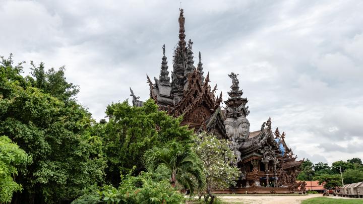
    The Sanctuary of Truth rises 105 metres above the coast at Naklua, a few kilometres north of central Pattaya, built entirely from teak with no nails, no concrete and no metal supports — every joint cut and interlocked using traditional Thai carpentry. It was begun in 1981 by Lek Viriyaphant, a self-made Thai-Chinese businessman who also created the open-air museum Ancient City and the Erawan Elephant Museum near Bangkok. Lek died in 2000, but construction never stopped: admission tickets now fund the ongoing work, and on any given day visitors can watch carvers actively shaping new panels rather than viewing a finished monument. More than four decades in, it's still explicitly unfinished, and that's by design.

    Four faces, one argument

    The structure is built around four wings, each drawing on a different artistic tradition — Thai, Khmer, Chinese and Indian — fused into a single silhouette that some describe as a kind of cosmic mandala. Every gable, pillar and panel is hand-carved with gods, mythical animals, elephants and human figures pulled from Buddhist and Hindu narratives. Lek's stated intent wasn't decorative: he believed that rapid technological progress was pulling people away from moral reflection, and he built the Sanctuary as a rebuttal in wood, a structure meant to argue that all these traditions converge on the same underlying truths about how to live.

    What the carvings actually show

    Look past the sheer scale and the carvings reward slow reading — cross-legged deities meditating above doorways, elephants bearing symbolic weight in Hindu cosmology, gods locked in poses drawn straight from temple reliefs in Angkor and Ayutthaya. Because it functions as a living workshop rather than a sealed monument, the wood ages visibly: newer sections show pale, raw teak, while older carvings have weathered to the dark grey-brown seen in most photographs, so a careful look across the building doubles as a rough timeline of forty-plus years of work.

    Practical details

    The site opens daily from 8am to 6pm, with last entry around 5pm; admission is 500 baht for foreign adults and 250 baht for children under 12 and for Thai nationals, with small discounts for booking online in advance. Shoulders and knees must be covered — sarongs are lent free of charge at the entrance for anyone who arrives underdressed. It's roughly 4 kilometres from central Pattaya: a Grab or taxi runs 80–120 baht and takes about 15 minutes, while a songthaew from Beach Road costs 10–20 baht but leaves a 1.5-kilometre walk or motorbike-taxi hop to the gate. Budget at least 2–3 hours, with 45–60 minutes for the main structure alone and the rest for the grounds, cultural shows and simply watching the carvers work.

    Why "unfinished" is the point

    Most landmarks are visited as completed objects; the Sanctuary of Truth asks to be seen mid-sentence. Scaffolding, active tools and half-carved beams aren't signs of neglect here — they're the clearest evidence that Lek's original argument about craft, patience and continuity is still being made, decades after the man who started it died.

    Sources

  • Travel

    A restrained guide to Samui's distinctive coastal rock formations, with practical attention to footing, weather, local conduct and changing access.

    3 min read

    Koh Samui: Hin Ta and Hin Yai as a coastal landscape stop

    Travel

    Koh Samui: Hin Ta and Hin Yai as a coastal landscape stop

    Last reviewed: 16 July 2026 Written by Ricardo Santos

    Anetta Kolesnikova / Pexels

    A restrained guide to Samui's distinctive coastal rock formations, with practical attention to footing, weather, local conduct and changing access.

    A landscape with a story attached before it has a sign

    At the southern end of Lamai Beach, a short stretch of granite coast has been given names — Hin Ta ("Grandfather Rock") and Hin Yai ("Grandmother Rock") — that only make sense once you hear the shapes described: a standing stone pillar and, nearby, a cleft in a cliff face, positioned close enough together that generations of visitors have read them as a pair. The names came from folklore first; the tourist attraction came after.

    The couple the rocks are said to be

    The story told locally follows an elderly couple, named in the telling as Ta Kreng and Yai Riam (spellings vary across retellings), who set out by boat from Nakhon Si Thammarat toward Prachuap Khiri Khan to arrange their son's marriage to the daughter of a man called Ta Monglai. A storm wrecked the boat off this stretch of coast, and both drowned. In the folk version, their bodies washed ashore and were transformed into the two rocks — a testament, the story goes, to how far they had been willing to travel for their son's wedding. The rocks are treated today as fertility and love symbols; small offerings are still left near them.

    What actually shaped the stone

    Strip away the legend and the geology is more mundane but still worth knowing: both formations are granite, worn into their current shapes by long-term erosion from sea spray, wind and sun rather than by any single dramatic event. Hin Ta is a freestanding granite pillar; Hin Yai is best understood as a weathered cleft or cavity in a coastal rock face, carved out by wave action over an extended period. It is the pairing of the two distinct forms, standing stone and hollowed cliff, that produced the resemblance the names describe — geology arriving, by coincidence, at a shape that folklore was ready to explain.

    Visiting without overselling it

    Access is free, and the site sits within Hat Lamai in Tambon Maret, close to the southern end of Lamai's beach strip — near enough to the town's main tourist area that most visitors combine it with a walk along the beach road rather than treating it as a separate excursion. A line of vendor stalls along the approach path sells coconut-wood carvings, bracelets and beachwear, which tells you this has been a stop on the tourist circuit for some time, even if no source pins down exactly when it became one.

    What to actually expect on the ground

    Published hours run roughly 8am to 6pm. Beyond that, be honest with yourself about what isn't well documented: there is no reliable published figure for walking time from central Lamai, and no consistent guidance on whether low or high tide makes for a better view — conditions along this stretch of granite shoreline shift with both the season and the swell, so the more useful approach is to check current local conditions on arrival rather than plan around a number nobody can actually confirm in advance.

    A stop, not a headline event

    Hin Ta and Hin Yai reward a modest amount of time — most visitors spend well under an hour here — and work best as one stop within a longer walk along Lamai's coastline rather than a destination that justifies a trip on its own. The rocks are unusual enough to be worth the short detour; the surrounding stalls and the beach itself are what make the stop feel worthwhile rather than merely photographed and left.

    Sources

  • Travel

    Sixty kilometres west of Hua Hin, Pa La-u Waterfall cascades through Kaeng Krachan National Park's forests — here's what to know about tiers, seasons, fees, and wildlife before you go.

    3 min read

    Hua Hin: preparing for Pa La-u Waterfall and its forest setting

    Travel

    Hua Hin: preparing for Pa La-u Waterfall and its forest setting

    Last reviewed: 16 July 2026 Written by Ricardo Santos

    Santasak Trirattanasak / Pexels

    Sixty kilometres west of Hua Hin, Pa La-u Waterfall cascades through Kaeng Krachan National Park's forests — here's what to know about tiers, seasons, fees, and wildlife before you go.

    Sixty kilometres from the beach, a different Thailand

    Pa La-u Waterfall sits inside Kaeng Krachan National Park, Thailand's largest protected area at nearly 2,900 km², roughly 60 km west of Hua Hin — about an hour and a half by car, though the last stretch winds through hills close enough to the Myanmar border that phone signal drops out. The falls are split into two named sections, Pa La-u Yai and Pa La-u Noi, cascading down what's commonly described as 16 tiers, though counts as low as 11 appear in older sources — treat the number as approximate. What matters practically: only the first four or five tiers on the Thai side are realistically reachable on foot; the rest fade into remote, largely unvisited terrain toward the border.

    Forest, not just water

    The park shifts from dry evergreen and deciduous dipterocarp forest at lower elevations to moist evergreen and montane forest higher up, and it's one of the richest wildlife sites in mainland Southeast Asia: seven of Thailand's fourteen hornbill species and all seven of its broadbill species have been recorded here, alongside elephants, gibbons, and even sun bears deeper in the park. Pa La-u itself is also a serious butterfly destination — around 300 species recorded park-wide, with the damp mineral patches near stream crossings sometimes drawing dozens of species at once in the early morning.

    What most guides don't say

    The bulk of Pa La-u's tiers are, in practice, off-limits to casual visitors — a fact tourist blogs tend to gloss over in favour of "16 stunning waterfalls." What they mention even less is who lives here: Kaeng Krachan is home to Karen (and some Hmong) communities whose presence predates the park's 1981 establishment, and the park's 2021 UNESCO World Heritage listing was genuinely controversial internationally because of documented tension between park authorities and these communities. It's worth knowing before framing the forest as untouched wilderness.

    When to go, and what it costs

    Foreign adults pay 300 baht to enter (children 200 baht), plus roughly 30 baht per vehicle; Thai nationals pay far less. The park generally operates 8:00 am to 5:00 pm, though hours can shift seasonally — confirm locally. Rainy season, June to October and peaking around September, brings the falls to their fullest and most dramatic, though trails turn slippery and leeches appear; the cool dry season, December to February, is far more comfortable to hike but the water thins noticeably, and by March–April some upper tiers can run close to dry.

    Practicalities

    There's no real public transport to the falls — most visitors arrive by rental car, motorbike, or organised tour from Hua Hin. Budget a half day: allow at least two hours for hiking between the accessible tiers, more if you plan to swim in the pools at the base (safe enough in dry season, best avoided in strong rainy-season currents). Bring water, sturdy shoes, a swimsuit, insect repellent, and cash for the entrance gate — and if you have time, the Karen villages nearer the park boundary are worth a respectful stop on the way back.

    Sources

  • Travel

    Twice a day, the Andaman Sea withdraws and a narrow ribbon of white sand surfaces between three Krabi islands. It is a tombolo, not a fixed path — and it follows the moon more than any tour schedule.

    2 min read

    Krabi: understanding Thale Waek and the tide-dependent sand connection

    Travel

    Krabi: understanding Thale Waek and the tide-dependent sand connection

    Last reviewed: 16 July 2026 Written by Ricardo Santos

    Balazs Simon / Pexels

    Twice a day, the Andaman Sea withdraws and a narrow ribbon of white sand surfaces between three Krabi islands. It is a tombolo, not a fixed path — and it follows the moon more than any tour schedule.

    A sandbar that only half-exists

    "Thale Waek" literally means "separated sea." The phenomenon is a tombolo: a sediment bridge shaped by wave refraction and diffraction around offshore obstacles, gradually depositing sand between two islands until it forms a temporary natural land bridge. Twice a day, as the Andaman Sea's tide retreats, a narrow, firm ribbon of white sand surfaces between three islands before disappearing again at high tide — a window of roughly two hours.

    Three islands, one strip of sand

    The tombolo links Koh Kai (Chicken Island), Koh Tup and Koh Mor in a rough T-shape. Most tours bundle it with nearby Koh Poda and Phra Nang Beach, sold as "4 Islands" trips.

    A little-known fact: the moon decides, not the calendar

    Because this is a genuine tombolo rather than a fixed isthmus, its width and even its exact shape shift with every tidal and lunar cycle. Locals recommend the five days before and after the 15th day of the waxing moon, when the month's lowest tides occur — meaning the "best" days to see it follow the lunar calendar rather than the Western one.

    How and when to go

    The dry season, November to May, offers the most reliable conditions; either way, time the visit around local tide tables rather than a fixed date. Long-tail boats or speedboats leave from Ao Nang Pier (about 25 minutes), Krabi Town or Railay Beach. Most visitors book a combined "4 Islands" boat tour.

    Budget and duration

    Expect to pay roughly 1,000-2,900 baht per person depending on the operator, boat type and inclusions (meals, snorkel gear). On top of that comes the Hat Noppharat Thara-Mu Ko Phi Phi National Park entry fee, separate from the boat fare: 400 baht for foreign adults, 40 baht for Thai nationals. Allow about two hours at the sandbar itself, and a half-day for a full multi-island tour.

    Sources

  • Travel

    A UNESCO-source guide to Phu Phrabat’s rock shelters and Sīma stone tradition, with a conservation-first approach to visiting the protected landscape.

    2 min read

    Udon Thani: reading Phu Phrabat as a sacred cultural landscape

    Travel

    Udon Thani: reading Phu Phrabat as a sacred cultural landscape

    Last reviewed: 16 July 2026 Written by Ricardo Santos

    Nathan Tran / Pexels

    A UNESCO-source guide to Phu Phrabat’s rock shelters and Sīma stone tradition, with a conservation-first approach to visiting the protected landscape.

    Why Phu Phrabat is exceptional

    UNESCO inscribed Phu Phrabat on the World Heritage List in 2024 as testimony to the Sīma stone tradition of the Dvaravati period. The property combines a distinctive rock-shelter landscape with evidence of prehistoric use and later Buddhist sacred boundaries. This layered significance means the visit should be read as a cultural landscape, not as a collection of isolated rock shapes.

    Understand Sīma in the landscape

    UNESCO explains that Sīma stones marked sacred areas for Buddhist activity and that Phu Phrabat preserves an exceptional in-situ body of this tradition on the Khorat Plateau. Look for the relationship between the stones, shelters and terrain rather than approaching each feature as a separate object. Use official interpretation to distinguish documented heritage from local stories.

    Respect prehistoric and religious evidence

    Rock art, stone markers and archaeological surfaces are irreplaceable evidence. Do not touch, trace, wet, climb or lean on them, and never cross a conservation barrier for a photograph. Religious meaning also continues beyond the archaeological record, so behave quietly around sacred areas and follow any current instruction concerning worship.

    Prepare for an outdoor heritage visit

    The property is a landscape, so weather, heat, rain and uneven ground affect the route. Wear suitable footwear, carry water where allowed and choose a public circuit compatible with your mobility. Stay on marked paths to protect both visitors and heritage. If part of the route closes, use the available interpretation rather than attempting an unofficial detour.

    Give the site enough time

    Phu Phrabat deserves to be the principal focus of the outing from Udon Thani rather than a hurried add-on. Leave transport and daylight margin, read the site information and accept that understanding the relationship between nature and sacred use takes time. Do not rely on an old map for current circulation.

    Current management comes first

    UNESCO describes a protected property led by Thailand’s Fine Arts Department with other public authorities and local participation. Opening arrangements, visitor capacity, conservation work and photography rules remain operational decisions. Verify them through the responsible authority before departure and treat on-site instructions as final.

    Sources and review

    This original SawaLife guide was researched and reviewed before publication. Operational details, access, weather, conservation rules, ceremonies and local instructions can change. Verify current official information before travelling.

    Sources

  • Travel

    At Sop Ruak, the Ruak and Mekong rivers draw the line where Thailand, Myanmar and Laos meet. A former opium heartland turned museum and viewpoint — worth visiting for the geography and the history, not for crossing anything.

    2 min read

    Chiang Rai: approaching the Golden Triangle as a border landscape

    Travel

    Chiang Rai: approaching the Golden Triangle as a border landscape

    Last reviewed: 16 July 2026 Written by Ricardo Santos

    Olivier Darny / Pexels

    At Sop Ruak, the Ruak and Mekong rivers draw the line where Thailand, Myanmar and Laos meet. A former opium heartland turned museum and viewpoint — worth visiting for the geography and the history, not for crossing anything.

    Where three countries meet

    At Sop Ruak, roughly 70km north of Chiang Rai town (about an hour to ninety minutes by road), the small Ruak River flows into the Mekong. It is exactly at this confluence that the borders of Thailand, Myanmar and Laos touch. From the Thai bank, you are literally looking at the other two countries without ever crossing into them — the scene is geographical and symbolic before it is any kind of crossing point.

    Where the name comes from

    The phrase "Golden Triangle" originated in a U.S. State Department memo describing the region's dominance of global opium production. Through the 1960s, Thailand alone produced an estimated 145 tonnes of raw opium a year, rivalling present-day Afghanistan. Hill-tribe farmers, Kuomintang remnant forces who had retreated south after 1949, and regional warlords — most notoriously Khun Sa — built an economy in which a kilo of raw opium traded for a kilo of gold.

    A little-known fact: the CIA and Air America

    During the CIA's secret war in Laos through the 1960s and 70s, its proprietary airline Air America flew logistics for anti-communist Hmong forces in the region. Historian Alfred McCoy argued this indirectly enabled opium transport through the Golden Triangle; later scholars dispute whether the CIA or its pilots were knowingly involved. It remains a contested footnote of Cold War history, tied directly to this stretch of river.

    From opium to coffee: the Royal Project

    In 1969, King Bhumibol Adulyadej founded the Royal Project Foundation, Thailand's first crop-substitution programme, replacing poppy fields with coffee, strawberries, macadamia and flowers. Credited with helping more than 100,000 people, it played a central role in ending Thai opium production. The trade is now memorialised rather than practised: the Hall of Opium, a large government-run museum about 2km north of Sop Ruak, traces its global history across multiple exhibition levels and a theatre space.

    Practical information

    The Hall of Opium is open 8am-4pm, entrance 200 baht. The smaller House of Opium, founded in 1990 by private collector Patcharee Srimatyakul, is open 7am-6pm, entrance 50 baht. Long-tail boats leave from the Sop Ruak pier for roughly 30-minute rides covering 5-6km with views of the tri-border point, at around 1,000 baht per person for an hour (shared boats cost less per head).

    Sources

  • Travel

    A 46-metre reclining Buddha with mother-of-pearl soles, over 1,000 UNESCO-listed medical and massage inscriptions: Wat Pho isn't just a monument — it was Thailand's first public university.

    3 min read

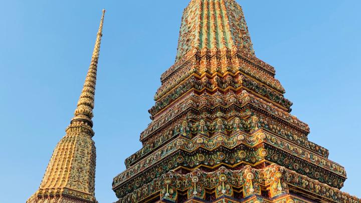
    Detail of Wat Pho's golden spires against a blue sky in Bangkok

    Travel

    Wat Pho, Bangkok: the temple that invented Thai massage and carved medicine into marble

    Last reviewed: 16 July 2026 Written by Ricardo Santos

    Scarlett Syu / Pexels

    A 46-metre reclining Buddha with mother-of-pearl soles, over 1,000 UNESCO-listed medical and massage inscriptions: Wat Pho isn't just a monument — it was Thailand's first public university.

    From an Ayutthaya-era temple to the kingdom's first public university

    Wat Pho has existed since the Ayutthaya period, dating to the reign of King Phetracha in the late 17th century, but it was Rama I who turned it, from 1788, into the founding temple of the new capital — a restoration and expansion project that took nearly eight years. Rama III gave it its definitive form in 1830 with an unprecedented ambition: turning the temple into a knowledge centre open to everyone, teaching medicine, literature, martial arts and astrology to a population with no access to formal schooling. Wat Pho effectively became the country's first public university, long before any modern institution carried that name.

    A 46-metre reclining Buddha with mother-of-pearl soles

    The reclining Buddha, completed in 1832 under Rama III, is 46 metres long and 15 metres high, depicting the Buddha's entry into nirvana. The soles of its feet, entirely inlaid with mother-of-pearl, are divided into 108 panels illustrating auspicious symbols — elephants, tigers, dancers, altar objects — arranged around a central dharma wheel. Along an adjoining corridor stand 108 bronze bowls, one for each auspicious characteristic: visitors drop coins into them, a merit-making gesture believed to bring good fortune.

    The birthplace of traditional Thai massage

    Few visitors realise Wat Pho is the birthplace of Thai massage as a codified discipline. Between 1831 and 1841, Rama III had over a thousand marble inscriptions carved around the temple: medical texts, body maps marking the "sen" energy lines, massage diagrams — a genuine public-health encyclopaedia carved in stone so anyone could study it freely. This collection, the Epigraphic Archives of Wat Pho, is now inscribed on UNESCO's Memory of the World Register. The temple still runs an active traditional massage school, and it remains possible to get a massage within the complex itself — a rare continuity between heritage and living practice.

    A vast site, not just a photo stop

    Beyond the reclining Buddha, Wat Pho holds over a thousand Buddha images spread across chapels, cloisters and courtyards — a complex large enough that a quick visit only scratches the surface. Shoes come off before entering buildings (plastic bags are provided to carry them), and shorts aren't allowed.

    Practical details

    The temple is open 8am–7:30pm, with a 300 THB entrance fee (free for children under 120cm). Allow one-and-a-half to two hours on site given the scale of the complex and the number of buildings worth seeing.

    Pairing it with Wat Arun, right across the water

    Wat Pho sits on the same riverbank as the Grand Palace, a short walk from Tha Tien pier, where a cheap cross-river ferry (3–5 THB) reaches Wat Arun on the opposite bank. The classic itinerary combines the Grand Palace early in the morning, Wat Pho by late morning, then a ferry crossing to Wat Arun for the late-afternoon light.

    Sources

  • Travel

    In 1767, a general on the run vows to build a temple at the exact spot where he lands at dawn. Two reigns later, its Khmer spire is clad in broken Chinese crockery — and it's at sunset, not dawn, that it truly comes alive.
    3 min read

    Wat Arun's prang lit up at sunset on the banks of the Chao Phraya

    Travel

    Wat Arun, Bangkok: a fleeing king's vow and the broken porcelain that glitters at sunset

    Last reviewed: 16 July 2026 Written by Ricardo Santos

    Kirandeep Singh Walia / Pexels

    In 1767, a general on the run vows to build a temple at the exact spot where he lands at dawn. Two reigns later, its Khmer spire is clad in broken Chinese crockery — and it's at sunset, not dawn, that it truly comes alive.
    A vow made at dawn, after a capital fell

    In 1767, the Burmese army sacked Ayutthaya, the Siamese capital for over four centuries. General Taksin, fleeing with what remained of his troops, sailed down the Chao Phraya and landed on the Thonburi riverbank at first light. He vowed to build a temple on that exact spot, naming it Wat Chaeng — the Temple of Dawn — after Aruna, the Hindu god of daybreak. Once crowned king, Taksin briefly housed the Emerald Buddha here, before the relic moved across the river to Wat Phra Kaew inside the Grand Palace compound.

    A Khmer spire dressed in broken crockery

    The 82-metre central prang was begun under Rama II but only completed in 1851, under Rama III — two generations of work for a single tower. Its shape follows that of a Khmer prasat, representing Mount Meru, the cosmic axis of the Buddhist-Hindu universe; four smaller prangs at the corners complete a layout that literally maps the cosmos. What sets Wat Arun apart from every other Bangkok temple is its skin: not precious stone, but fragments of broken Chinese porcelain, which arrived by the ton as simple ballast in Chinese trading junks, topped up with crockery donated by Bangkok residents. Set into cement as floral mandalas and chrysanthemum chains, these ceramic shards catch and scatter low-angle light — the concrete, not just poetic, reason the temple glitters.

    The "Temple of Dawn" paradox

    Despite its name, Wat Arun is at its most spectacular at sunset, not dawn — a paradox few visitors expect. The best viewpoint isn't even the temple itself, but the opposite riverbank near Wat Pho's Tha Tien pier, where the prang's silhouette cuts against an orange sky and reflects in the river. Local folklore adds a legendary twist: the guardian giants (yaksha) at Wat Arun's entrance are said to be the very same pair locked in combat with their counterparts at Wat Pho in the Ramakien epic — split between the two riverbanks.

    Climbing the prang, step by step

    A steep, narrow central staircase leads partway up the prang for a close-up look at its ornamentation and a view over the river below — good shoes and a bit of caution are needed, as the steps are tall and tightly spaced. Allow roughly one to one-and-a-half hours on site if you plan to climb.

    Practical details and the best time to go

    The temple is open 8am–6pm, with last entry around 5:30pm, for a 200 THB entrance fee. The dress code is strict — shoulders and knees covered — with sarongs available for rent on site for visitors caught unprepared. To dodge the crowds, two windows stand out: early morning between 8 and 10am for quiet, or late afternoon between 4 and 5:30pm for the golden light before sunset. It's reached from the historic centre by a cheap cross-river ferry (3–5 THB) departing from Tha Tien pier.

    Pairing it with Wat Pho, right across the water

    Wat Arun sits directly across the Chao Phraya from Wat Pho, linked by that same inexpensive ferry. The classic itinerary combines the Grand Palace early in the morning before the crowds, Wat Pho by late morning, a ferry crossing, then Wat Arun in the late afternoon to catch the low light through to sunset.

    Sources