Skip to content
BETA

Menu

Account

Language

Practical Thailand guides

Practical Thailand guides

Step-by-step guidance for planning a trip, a longer stay or a move to Thailand.

  • Travel

    Inside the walled 218,000 m² compound where Rama I founded Bangkok in 1782: a jade Buddha with a 300-year odyssey, three seasonal costumes, and a royal chapel with no monks.

    3 min read

    Bangkok: the Grand Palace and Wat Phra Kaew

    Travel

    Bangkok: the Grand Palace and Wat Phra Kaew

    Last reviewed: 16 July 2026 Written by Ricardo Santos

    Ana / Pexels

    Inside the walled 218,000 m² compound where Rama I founded Bangkok in 1782: a jade Buddha with a 300-year odyssey, three seasonal costumes, and a royal chapel with no monks.

    A capital founded in a single decree

    When King Rama I crossed the Chao Phraya from Thonburi in 1782 to found the new Chakri capital, the first structure he ordered built wasn't a palace hall — it was a walled royal chapel to house the kingdom's most sacred object. That chapel, Wat Phra Kaew, still stands inside the 218,000 m², 1.9 km-long walled compound of the Grand Palace, and it remains the only Thai temple with no resident monks: it exists purely as the private chapel of the monarchy, mirroring a layout Rama I copied from the fallen Ayutthaya and Sukhothai courts he was determined to resurrect in miniature.

    A green stone with a 300-year detour

    The temple's namesake is not actually emerald. The Phra Kaew Morakot is carved from a single block of green jasper (or jadeite, depending on the source), and its documented story begins in 1434 in Chiang Rai, when lightning cracked open a stucco-covered chedi and monks found a gilded Buddha figure inside. It took years before a flake of plaster fell away to reveal green stone underneath. What followed reads like a relic on the run: Chiang Rai to Lampang, then Chiang Mai, then — remarkably — north to Luang Prabang and Vientiane in Laos, where it stayed for over two centuries. It only returned to Siam in 1778-79, carried back by the general who would become Rama I after a military campaign, and it has not left Bangkok since.

    Three wardrobes for one Buddha

    Twice a year, at the change of season, the King or a senior royal family member personally changes the Emerald Buddha's costume — a ceremony instituted by Rama I himself and still performed today. There is a gilded robe for the hot season, a gold-and-blue enamel set for the rains, and a solid-gold mesh cloak for the cool months. The figure itself is small, just 66 cm tall including its base, seated on a tall gilded traymasat altar that dwarfs it — deliberately, since scale here signals sanctity rather than spectacle.

    Reading the compound like a map

    Twelve marble pavilions ring the Convocation Hall, each marking a cardinal point of the sacred boundary; look for the Phra Si Rattana Chedi sheathed in gold mosaic tiles and the Phra Mondop library raised on a base to keep flood water from the palace's original scriptures. The murals lining the cloister gallery — over 1.9 km of them — narrate the entire Ramakien, Thailand's version of the Ramayana, painted and repainted since Rama I's reign whenever the tropical climate wore the pigment away.

    Practical planning

    The complex opens daily 8:30am-4:30pm, with the last ticket sold at 3:30pm — arrive by mid-morning if you want to avoid both the heat and the tour-group crush. Entry costs 500 THB for foreign visitors, which also includes the Queen Sirikit Textile Museum on-site; Thai nationals enter free with ID. The dress code is strictly enforced: no shorts, sleeveless tops, see-through fabric or tight clothing — sarongs are loaned free at the entrance if needed. The easiest access is BTS to Saphan Taksin, then the Chao Phraya express boat to Tha Chang pier, or MRT to Sanam Chai station followed by a short walk. Budget two to three unhurried hours, not a quick photo stop.

    Source: Royal Grand Palace official visitor information, royalgrandpalace.th

    Sources

  • Travel

    A relic carried by an elephant, 309 naga-flanked steps, and a view over the whole Chiang Mai valley: the founding legend of Wat Phra That Doi Suthep, and how to visit without the crowds.

    3 min read

    Doi Suthep, Chiang Mai: the white elephant that picked a temple's location

    Travel

    Doi Suthep, Chiang Mai: the white elephant that picked a temple's location

    Last reviewed: 18 July 2026 Written by Ricardo Santos

    Photo by Luca Sammarco / Pexels

    A relic carried by an elephant, 309 naga-flanked steps, and a view over the whole Chiang Mai valley: the founding legend of Wat Phra That Doi Suthep, and how to visit without the crowds.

    A legend that literally drew the route

    According to the 14th-century founding legend, a monk received a dream instructing that a Buddha relic be placed on the mountain, without knowing exactly where. King Kuena's solution was to load the relic onto a sacred white elephant and let it walk freely: the animal climbed the mountain, trumpeted three times at the summit, turned in a circle, then collapsed and died on that exact spot — taken ever since as the place the spirits intended. The temple was built precisely where the elephant stopped, which explains a location that, from a purely practical standpoint, makes no obvious sense.

    The naga staircase: 309 steps as a symbolic threshold

    Climbing to the temple via the historic staircase flanked by two seven-headed mosaic nagas (mythical serpents) means ascending 309 steps, conceived as spiritual progress rather than mere practical access — a funicular exists for those who can't or don't want to climb, but taking the stairs remains the closest experience to what pilgrims have done for centuries. At the top, the central gold chedi, visible from much of the Chiang Mai valley on a clear day, holds the relic itself — direct access is restricted, but visitors circle it clockwise, as tradition requires.

    Summit etiquette: what sets this site apart from lowland temples

    Doi Suthep remains an active pilgrimage site, not just a scenic overlook: shoulders and knees must be covered to enter the chedi enclosure (sarongs are lent free at the entrance if needed), shoes come off before certain sanctuary areas, and the relative quiet around the gold chedi contrasts with the bustle of the car park and stalls below. The bells hung around the enclosure can be rung by visitors as a gesture of good fortune — one of the few ritual acts openly extended to non-Buddhists.

    When to climb to avoid the afternoon crush

    Air-conditioned buses and tour taxis arrive mostly between 10am and 3pm, when groups combine Doi Suthep with a half-day city loop; climbing early morning (the temple usually opens around 6am) lets you watch the monks' morning rituals and see the valley still veiled in mist before the heat burns it off. The drive from Chiang Mai takes about 30-45 minutes by shared red songthaew or private taxi, along a winding but well-maintained mountain road.

    Beyond the temple: the summit keeps going

    Few visitors continue past the temple car park to Phuping Palace, a royal summer residence open to the public on certain days with rose gardens blooming December to February, or to the Hmong village of Doi Pui a few kilometres further up — two simple extensions that turn a temple visit into a full half-day in the hills above Chiang Mai.

    Sources

  • Travel

    Two 14th-century Lanna temples, ten minutes apart: one holds a Buddha image that sailed from Sri Lanka, the other a 500-year-old earthquake scar left deliberately unrepaired.

    3 min read

    Chiang Mai: read the Old City through Wat Phra Singh and Wat Chedi Luang

    Travel

    Chiang Mai: read the Old City through Wat Phra Singh and Wat Chedi Luang

    Last reviewed: 16 July 2026 Written by Ricardo Santos

    Mineia Martins / Pexels

    Two 14th-century Lanna temples, ten minutes apart: one holds a Buddha image that sailed from Sri Lanka, the other a 500-year-old earthquake scar left deliberately unrepaired.

    Two temples, one dynasty

    Both temples trace back to the Mangrai dynasty that founded Chiang Mai in 1296, and walking between them — barely ten minutes on foot inside the moated Old City — is effectively a walk through the first century of Lanna kingship. Wat Phra Singh was founded in 1345 by King Pha Yu to enshrine the ashes of his father, King Kham Fu, under its original name, Wat Lichiang Phra. Wat Chedi Luang rose in the same century a short walk away, and for two hundred years the pair anchored the spiritual geography of a capital built to rival Sukhothai.

    A Buddha image that took a decade to arrive

    Wat Phra Singh only gained its present name after 1367, when the Phra Buddha Sihing image reached Chiang Mai — legend holds it was originally cast in Sri Lanka and shipped in stages via Nakhon Si Thammarat and Kamphaeng Phet before finally completing its journey north. It remains enshrined in the Wihan Lai Kham, a hall decorated with rare Lanna-style murals depicting the Suphannahong legend that art historians say survive nowhere else in this form — faded, hand-painted narrative scenes rather than the gilded relief work found in most Bangkok temples.

    The chedi the earthquake couldn't finish

    Wat Chedi Luang's defining feature is damage, not decoration. Its chedi originally rose to roughly 80 metres, making it the tallest structure in the old kingdom, until a massive earthquake in 1545 sheared off its upper section, leaving today's roughly 60-metre ruin. Restoration attempts in the 1990s stopped short of full reconstruction, so what visitors see is genuine 16th-century damage rather than a modern replica — a rare case of a monument being conserved as a wound rather than repaired into looking new. The temple briefly held an even more famous resident: the Emerald Buddha itself was enshrined here between 1468 and 1551, before being moved for safekeeping after the same 1545 quake chipped its housing.

    The city's actual foundation stone

    Easy to miss on the temple grounds is the Sao Inthakin, Chiang Mai's city pillar — first erected in 1296 at the city's founding and relocated into Wat Chedi Luang's compound around 1800 by King Kawila. It functions as the symbolic anchor of the city itself, and the small shrine housing it is traditionally closed to women, a custom still observed today.

    Practical planning

    Wat Chedi Luang opens roughly 6am to 6pm, with the main hall closing slightly earlier; entry is 40 THB for adults, 20 THB for children, free for Thai nationals. Wat Phra Singh opens around 8am to 5pm and operates on a donation basis at most entrances, though some access points post a 20-40 THB fee — worth confirming on arrival. Both enforce a standard dress code: shoulders and knees covered, shoes off before entering any hall. They sit an easy walk or short songthaew ride apart inside the Old City's square moat. Allow around 45 minutes at each, more if the Wihan Lai Kham murals or the city pillar shrine interest you.

    Source: Tourism Authority of Thailand, tourismthailand.org

    Sources

  • Travel

    Phuket Old Town's Sino-Portuguese shophouses were built on tin money, not tourism — and the quietest lane, Soi Romanee, has the most revealing past.

    3 min read

    Phuket: reading the Sino-Portuguese facades of the Old Town

    Travel

    Phuket: reading the Sino-Portuguese facades of the Old Town

    Last reviewed: 16 July 2026 Written by Ricardo Santos

    Luca Sammarco / Pexels

    Phuket Old Town's Sino-Portuguese shophouses were built on tin money, not tourism — and the quietest lane, Soi Romanee, has the most revealing past.

    A town built on tin, not sand

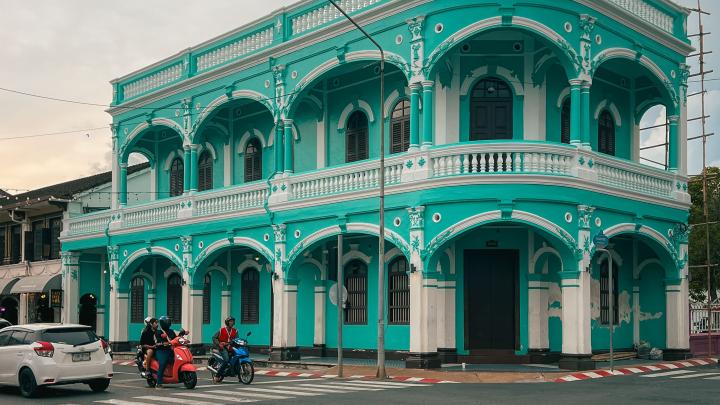
    Long before Phuket became a byword for beaches, its wealth came from underground. From the late 18th century through the early 20th, Hokkien Chinese migrants worked tin deposits across the island, and the profits built a town a few kilometres inland from the coast. By the reign of King Rama V (1868-1910), the streets around Thalang, Dibuk, Krabi, Phang Nga and Yaowarat roads had filled with two-storey shophouses whose owners could afford to build in the fashionable style of the era: Sino-Portuguese.

    Where the style actually comes from

    The name is a shorthand, not a precise pedigree. Wealthy Hokkien merchants hired builders trained in the Portuguese-influenced architecture of Malacca and Penang, across the Strait of Malacca, and imported the look wholesale: shuttered windows, five-foot covered arcades running the length of each block, stucco garlands, and shophouse footprints rarely wider than six metres but sometimes eighty deep, courtyard after courtyard receding toward a rear kitchen. No single building marks the style's arrival in Phuket — it simply became the town's default over a few decades of tin-fuelled construction.

    Read the street, not just the postcard

    Thalang Road is the most photographed stretch, and deservedly so, but the more revealing walk is one block over on Soi Romanee. This narrow lane of candy-coloured facades was, within living memory, Phuket's red-light district, serving tin miners who had no families on the island. Its current prettiness is a second life, not the original one — a reminder that Old Town streets were working streets, not designed backdrops.

    The Baba-Peranakan thread

    Many of the tin fortunes were built inside mixed households: Hokkien miners married Siamese women, and their descendants, the Baba-Peranakan community, blended Chinese ancestor rites with Thai dress, language and food into something particular to this coast. Chinpracha House on Krabi Road, still lived in by descendants of the family that built it in 1903, is the clearest place to see that domestic world rather than just its street-facing shell.

    Walk it on a Sunday if you can

    On Sunday evenings, Thalang Road closes to traffic for the Lard Yai walking street market, when the same facades that once fronted tin-trading offices host food stalls late into the night. It's touristy, but it also fills the street with exactly the kind of foot traffic the shophouses were built to handle — a rare moment when the Old Town feels used rather than preserved.

    Before you go

    Wear comfortable shoes for uneven five-foot ways, carry water for the middle of the day, and time a first pass for late afternoon when the light is kinder to the facades and the heat has eased. A slow 90-minute loop covering Thalang, Dibuk, Krabi and Soi Romanee is enough for a first visit; add the Thai Hua Museum and Chinpracha House if you want the interiors as well as the exteriors.

    Verification before travel

    This SawaLife guide was researched and reviewed before publication. Opening hours, road closures, market schedules and conservation rules can change. Verify current details before travelling via the Tourism Authority of Thailand — Phuket Old Town.

    Sources

  • Travel

    Wat Chalong owes its fame to a 19th-century rebellion its monks helped survive — and it's still a working temple, not a monument.

    3 min read

    Phuket: Wat Chalong, the temple that sheltered a rebellion's wounded

    Travel

    Phuket: Wat Chalong, the temple that sheltered a rebellion's wounded

    Last reviewed: 16 July 2026 Written by Ricardo Santos

    Namfon Sasimaporn / Pexels

    Wat Chalong owes its fame to a 19th-century rebellion its monks helped survive — and it's still a working temple, not a monument.

    A temple born from an uprising

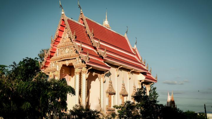
    Wat Chalong's full name is Wat Chaiyathararam, but almost no one uses it. The temple owes its fame to 1876, when Chinese tin-mine labourers rose up in what became known as the Ang Yi rebellion, attacking mining camps and a nearby town. Two monks then resident at the temple, Luang Pho Chaem and Luang Pho Chuang, organised local villagers to defend Chalong and used their knowledge of herbal medicine to treat the wounded on both sides. Luang Pho Chaem, who lived until 1908, remains the most venerated monk in Phuket's history; his statue, alongside Luang Pho Chuang's, still receives gold leaf and incense from visitors who have never opened a history book on the rebellion.

    The chedi that holds a splinter of bone

    The temple's dominant structure is a 60-metre chedi, built on three tiered levels that visitors can climb inside. It houses what devotees believe is a fragment of the Buddha's breastbone, displayed behind glass on the upper level alongside murals depicting the Buddha's life. Climbing to the top is less about the relic itself than the view it grants: a wide look over Chalong's low rooftops toward the hills that separate this side of the island from the beach resorts most visitors never leave.

    A working temple, not a museum piece

    Wat Chalong opens at 7:00 a.m. and closes at 5:00 p.m., with no entry fee — donation boxes are placed discreetly rather than at a ticket counter. Monks live and study on the grounds, ordinations and merit-making ceremonies happen on ordinary weekdays, and the compound routinely hosts far more Thai visitors than foreign ones. That imbalance is worth noticing: this is one of the few major Phuket sites where tourism is a secondary activity layered onto an active religious institution, not the other way around.

    What the etiquette actually protects

    Cover shoulders and knees before entering any building — sarongs are sometimes available to borrow near the entrance, but arriving already dressed avoids a wait. Remove shoes at chapel doors, keep your head lower than seated monks or Buddha images where practical, and never let the soles of your feet point toward a statue when sitting. These aren't arbitrary rules for visitors; they're the same conduct expected of Thai worshippers, which is part of why the temple still feels lived-in rather than staged.

    Getting there and timing the visit

    Wat Chalong sits about 8 kilometres from Phuket Town and roughly 20 minutes by car from Patong, reachable by metered taxi, ride-hailing app or the regional songthaew network running along Chao Fah Road. Most visits run 45 minutes to an hour: enough time for the main chedi, the ordination hall with its ceiling murals, and the market stalls that spill from the car park toward the entrance selling amulets, birds released for merit, and the temple's own herbal remedies — a direct, still-functioning echo of 1876.

    Verification before travel

    This SawaLife guide was researched and reviewed before publication. Opening hours, ceremonies and access conditions can change. Verify current official information before travelling via the Tourism Authority of Thailand — Phuket cultural route.

    Sources

  • Travel

    A former quarry fifteen kilometres south of Pattaya carries a 130-metre gold Buddha outline, laser-drawn onto the cliff in two nights in 1996.

    3 min read

    Pattaya: Khao Chi Chan Buddha Mountain

    Travel

    Pattaya: Khao Chi Chan Buddha Mountain

    Last reviewed: 16 July 2026 Written by Ricardo Santos

    Kim Villanueva / Pexels

    A former quarry fifteen kilometres south of Pattaya carries a 130-metre gold Buddha outline, laser-drawn onto the cliff in two nights in 1996.

    A quarry that became a portrait of the king

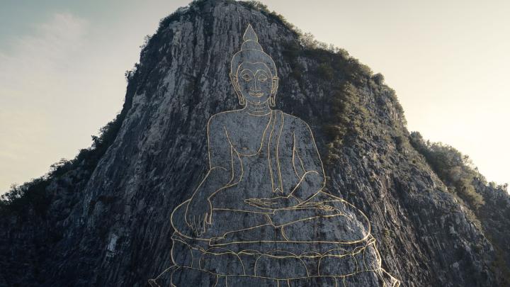
    Fifteen kilometres south of central Pattaya, a limestone hill called Khao Chi Chan carries a 130-metre-high, 70-metre-wide outline of a seated Buddha, drawn in gold leaf directly onto the bare rock. The image, officially named Phra Phuttha Maha Wachira Uttamopat Satsada, was commissioned in 1996 to mark the fiftieth anniversary of King Bhumibol Adulyadej's accession to the throne — the Golden Jubilee. Before that date, the mountain had a much less serene history: quarrying during the Vietnam War supplied stone for the runways of U-Tapao airbase, then in the following decades illegal mining chipped away at the cliff face for construction material, leaving a raw scar that the government decided to consecrate rather than simply close off.

    Two nights with a laser, months with gold leaf

    What makes Khao Chi Chan unusual isn't its size — Thailand has other giant Buddha images — but how it was made. Engineers projected the outline using a 20-watt argon-ion laser, tracing the contours of a seated Buddha in the Sukhothai style directly onto the cliff. Because the beam only showed up clearly against darkness, the actual marking was done at night; the full engraving was completed in two nights. Only after the lines were cut into the rock did craftsmen begin filling the grooves with gold leaf, a slower process that took several months. It remains, by most accounts, the only Buddha image of this scale ever produced with laser-guided carving.

    Reading the pose

    The Buddha sits cross-legged, right hand resting open on the right knee, left hand upturned in the lap — the bhumisparsha mudra, the gesture said to mark the exact moment of enlightenment under the Bodhi tree, when Buddha called the earth to witness his awakening. Sukhotho-era proportions give the face a calm, elongated symmetry rather than the more muscular modelling of later Ayutthaya-style images, which is part of why the outline reads so cleanly from a distance despite having almost no three-dimensional relief.

    Visiting

    Entry to the site is free, and it's open daily from 8am to 5pm. At the base of the mountain, landscaped gardens with lotus ponds and small shrines give the golden outline room to breathe rather than crowding right up to the rock. There's no direct public bus route; most visitors arrive by chartered songthaew or taxi from central Pattaya, a ride of roughly 20–30 minutes depending on traffic, and it's commonly combined with a stop at a nearby temple since the site itself only needs 30–45 minutes to see properly. Come in the late afternoon if you can — the low sun catches the gold leaf and makes the outline noticeably brighter against the darkening limestone.

    Why it still matters locally

    Beyond the postcard image, Khao Chi Chan is a rare case of a damaged industrial landscape being reclaimed for religious and civic meaning rather than redeveloped or abandoned. For a coastal district built largely around nightlife and beach tourism, the mountain functions as a counterweight: a free, quiet, unmistakably Thai landmark that draws both pilgrims and sightseers without an entrance fee filtering who gets to see it.

    Sources

  • Travel

    A 30-minute ferry from Bali Hai Pier reaches Koh Lan's six beaches and 3,000 residents, but the island runs on a strict boat timetable, not a fixed schedule.

    3 min read

    Pattaya: Koh Lan as a day-trip island

    Travel

    Pattaya: Koh Lan as a day-trip island

    Last reviewed: 16 July 2026 Written by Ricardo Santos

    Gyan Pratim Raichoudhury / Pexels

    A 30-minute ferry from Bali Hai Pier reaches Koh Lan's six beaches and 3,000 residents, but the island runs on a strict boat timetable, not a fixed schedule.

    An island that lives on a ferry timetable

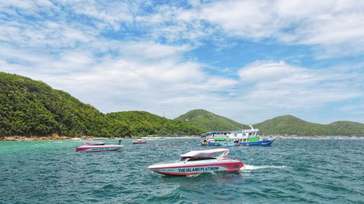
    Koh Lan sits 7.5 kilometres off Pattaya's coast, close enough that the crossing from Bali Hai Pier takes about half an hour by regular ferry, or as little as 15 minutes by speedboat. The island itself is small — roughly 4 kilometres long, 2 wide, about 5.6 square kilometres in total — but its rhythm is dictated less by geography than by boat schedules. Ferries leave Pattaya at 07:00, 10:00, 12:00, 14:00, 15:30, 17:00 and 18:30; the last boat back from the island departs at 18:00, with a second overflow boat ten minutes later for anyone who misjudged the tide of the day. Fares have crept up over the years — the standard one-way ferry ticket, long fixed at 30 baht, rose to 40 baht in early 2026 — while speedboats run 150–300 baht depending on route and whether it's one-way or return.

    A working island, not a resort shell

    Around 3,000 people live on Koh Lan year-round, most of them clustered near Na Ban pier on the island's eastern side, and daily life there looks nothing like the beach clubs a few hundred metres away. There are almost no cars; getting around means walking, hopping on a motorbike taxi, or squeezing into a songthaew truck that loops the main roads. Fishing families, small guesthouses and market stalls share the same narrow lanes that day-trippers use to reach the beaches, which keeps the island feeling inhabited rather than staged for tourists — a distinction that's increasingly rare this close to a major resort city.

    Six beaches, six different moods

    Tawaen Beach, on the island's northwest side, is the busiest by far: parasailing, jet skis, banana boats and a dense row of beach chairs make it feel like an extension of Pattaya itself. Samae Beach is quieter and notable for something most visitors miss entirely — solar panels and small wind turbines installed along the shoreline, part of an effort to reduce the island's dependence on diesel generators and undersea cabling. Tien Beach draws a slower crowd with clearer water for swimming, while Nual Beach at the southern tip is the most remote of the six, occasionally visited by monkeys that come down from the wooded hills behind it looking for food dropped by picnickers.

    Planning the day

    Realistically, budget 7 to 8 hours if you're doing this independently: ferry over, time on one or two beaches, lunch, ferry back, with margin for the inevitable wait at the pier. Organised day-trip packages run 500–600 baht including hotel pickup around 9am, the ferry crossing, lunch and a return by mid-afternoon — useful if you'd rather not manage the ferry timetable yourself, though they trade away flexibility on which beach you actually reach. There's no general entrance fee to the beaches themselves; costs come from optional water sports, beach chair rental and food.

    The trade-off worth knowing

    Koh Lan is not a substitute for Thailand's more famous southern islands — the water is serviceable rather than spectacular by regional standards, and on weekends the ferries and beaches both fill fast with Pattaya day-trippers. What it offers instead is proximity: a genuine change of pace and scenery reachable and returnable within a single afternoon, without committing to an overnight island stay or a long transfer south.

    Sources

  • Travel

    A 12-metre gold Buddha on a tidal islet off Koh Samui's northeast coast, and the small rituals of dress and conduct that keep a working temple working.

    3 min read

    Koh Samui: Phra Yai and temple etiquette by the sea

    Travel

    Koh Samui: Phra Yai and temple etiquette by the sea

    Last reviewed: 16 July 2026 Written by Ricardo Santos

    Nirjhar Basak / Pexels

    A 12-metre gold Buddha on a tidal islet off Koh Samui's northeast coast, and the small rituals of dress and conduct that keep a working temple working.

    A giant that sits on its own tide

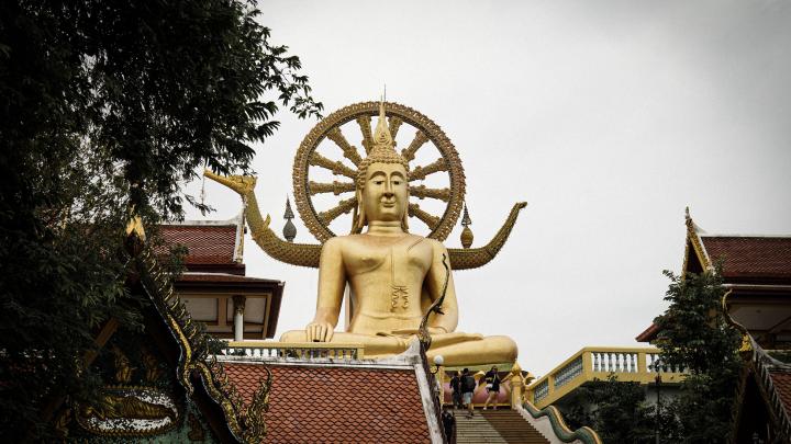
    Come at Koh Samui from the north-east and the first landmark you register from the airport road is not a beach but a statue: a seated Buddha, 12 metres of gold-painted concrete, rising above the causeway that ties the mainland to a speck of land called Ko Faan. The islet is small enough to walk around in under ten minutes, and the statue was finished in 1972, paid for the way most working Thai temples are paid for — not by a single royal or corporate donor, but by an accumulation of small offerings from islanders and, later, from the visitors who kept coming. Locals simply call the place Wat Phra Yai, "the temple of the big Buddha." Tourism brochures added the nickname that stuck internationally.

    The gesture the statue is making

    Look closely before you photograph it: the right hand rests over the knee, fingertips reaching toward the ground, while the left lies open in the lap. This is the bhumisparsha pose, "touching the earth," the moment in the Buddha's story when he responds to the temptations and illusions of the demon Mara not with argument but by calling the earth itself to witness his resolve. It is one of the most common gestures in Thai religious art, but few visitors are told what it means as they climb the naga-flanked staircase toward the platform.

    Layers added over fifty years

    The temple has not stood still since 1972. A large ceremonial prayer wheel was installed behind the main statue only in 2012, four decades after the original build, and a smaller, separate statue depicting Maitreya — the Buddha still to come, in Thai belief — sits elsewhere on the grounds. The serpent balustrades lining the entrance stairs are a standard feature of Thai temple architecture, drawn from older Brahmanic and animist symbolism that Thai Buddhism absorbed rather than replaced. None of this is explained by a sign at the entrance; it rewards asking, or reading, before you go.

    What the dress code actually requires

    Entry is free, though donation boxes are placed discreetly around the platform and giving something small is customary rather than optional in spirit. The rule that is not optional: shoulders and knees covered for both men and women, and shoes removed before stepping into any covered shrine building. Sarongs are sold or lent at the entrance for anyone arriving in shorts or a tank top, so being turned away is avoidable but embarrassing if it happens.

    Getting there and timing it well

    From Chaweng, the drive is short — about 6 kilometres, some 15 minutes by road, since the temple sits close to Samui International Airport on the island's northeast tip. A shared songthaew runs roughly 70 baht per person if you can flag one heading the right way; chartering one privately or negotiating a taxi lands closer to 200-300 baht one-way. Most visits last 30 to 45 minutes, which is enough to see the statue, the smaller shrines, and the row of stalls selling drinks and souvenirs at the base of the causeway.

    Why sunset earns its reputation

    The temple opens early, generally from around 6 to 8 in the morning depending on the season, and stays accessible into the evening, typically until 6pm. Early morning avoids the tour buses; late afternoon, roughly between 5:30 and 6:30pm, is when the gold statue catches the low light against the sea — a genuinely photogenic hour, not just a marketing line, and one where a few extra minutes of patience for the crowd to thin is worth it.

    Sources

  • Travel

    Forty-two limestone islands protected since 1980, reached by boat from the Samui area — a marine park where conditions, fees and low-impact conduct genuinely matter.

    3 min read

    Koh Samui: approaching Mu Ko Ang Thong Marine National Park responsibly

    Travel

    Koh Samui: approaching Mu Ko Ang Thong Marine National Park responsibly

    Last reviewed: 16 July 2026 Written by Ricardo Santos

    Peggy Anke / Pexels

    Forty-two limestone islands protected since 1980, reached by boat from the Samui area — a marine park where conditions, fees and low-impact conduct genuinely matter.

    A park older than the resorts around it

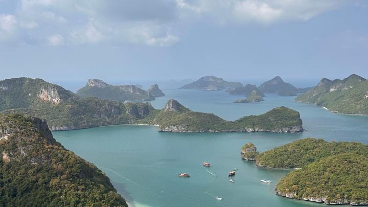
    Mu Ko Ang Thong was declared Thailand's 21st national park on 12 November 1980, following preliminary talks between the Ministry of Defense and the Royal Forest Department that began a few years earlier. It protects 42 islands scattered over roughly 102 square kilometres of the Gulf of Thailand, of which only about half is land — the rest is the shallow, current-swept sea between the limestone outcrops. Since 2002 the whole archipelago has also carried Ramsar Wetland status, a designation reserved for wetlands judged internationally significant. The park predates almost every hotel now operating on Koh Samui's beaches.

    The novel it really did inspire — and the film it didn't

    Ang Thong has a literary footnote that is often repeated and only half-true. Alex Garland, then a young backpacker, heard about the archipelago's hidden lagoon while on Koh Phangan in the 1990s, and it became a real inspiration for his novel The Beach. What did not happen here is the film: Danny Boyle's 2000 adaptation was shot at Maya Bay on Koh Phi Phi Leh, chosen for easier production logistics. Visitors who arrive expecting a film set are looking in the wrong archipelago — what they find instead is the actual place that seeded the story.

    An emerald lake sealed inside a mountain

    The park's signature sight is Thale Nai, the "Inland Sea," a saltwater lake inside Ko Mae Ko connected to the open ocean only through unseen limestone caves and fissures beneath the cliffs — not by any visible channel. Reaching the viewpoint above it means a roughly 20-minute walk from the landing point. On neighbouring Ko Wua Talap, the park's tallest viewpoint trail is a genuinely steep 500-metre climb, parts of it rope-assisted, rewarding the effort with a view over the whole scattered archipelago at once.

    What actually lives here

    Ang Thong is not just scenery. Surveys count roughly 16 mammal species across the islands, including dusky leaf monkeys, long-tailed macaques, and — more elusive — leopard cats and fishing cats, alongside smooth-coated otters working the tidal margins. Around 50 bird species and more than a dozen reptile species round out a park that functions as a real, if compact, wildlife refuge rather than a purely scenic backdrop.

    Fees, seasons and getting there

    Entry runs about 300 baht for a foreign adult and 150 baht for a foreign child, against 50 baht (adult) and 25 baht (child) for Thai nationals; boat transport is arranged and paid separately through tour operators from Nathon or Bophut piers on Koh Samui, or from Koh Phangan. The park closes to visitors roughly from 1 November to 15 December each year for the monsoon, and the calmest, clearest conditions generally run from January to March. Camping is permitted on a couple of islands for about 80 baht per person per night, with tents rentable on-site for around 450 baht.

    Conduct that keeps the park intact

    None of this survives casual treatment: no touching or standing on coral, no plastic left behind, no removing shells or rock. Boat operators brief this before departure, but the responsibility to follow it does not end at the briefing — a marine park with this much protected status stays worth visiting only if every visitor treats it that way.

    Sources

  • Travel

    Opened in 1911 and rebuilt in 1926, Hua Hin's railway station pairs a working platform with a royal pavilion relocated from Nakhon Pathom — one of Thailand's most photographed train stations.

    3 min read

    Hua Hin: the railway station as a heritage landmark

    Travel

    Hua Hin: the railway station as a heritage landmark

    Last reviewed: 16 July 2026 Written by Ricardo Santos

    Ahmad Anafee / Pexels

    Opened in 1911 and rebuilt in 1926, Hua Hin's railway station pairs a working platform with a royal pavilion relocated from Nakhon Pathom — one of Thailand's most photographed train stations.

    A station built for a king

    Hua Hin Railway Station opened on 25 November 1911, the year King Vajiravudh (Rama VI) came to the throne and began pushing the Southern Line down the Malay Peninsula. The stop turned a fishing village into a resort: within a decade the king had built Maruekhathaiyawan, his "palace of love and hope," a few kilometres up the coast, and the railway was the reason wealthy Bangkok families could reach the sea in a single night's journey. The building visitors photograph today isn't the 1911 original — it's a 1926 rebuild, overseen by Prince Purachatra Jayakara, then director of the Royal State Railways of Siam, and its red-and-cream, wood-and-masonry silhouette has barely changed since.

    The pavilion that traveled twice

    The station's most photographed structure isn't the platform building at all — it's the small, four-gabled royal waiting pavilion standing apart from it, painted in ochre and red under a steep teak roof. It wasn't built for Hua Hin. It began life at Sanam Chandra Palace in Nakhon Pathom, roughly 200 km north, where Rama VI used it during military drills. After his death it was dismantled and re-erected here — sources differ on whether that happened in 1967 or 1974, so treat the date as approximate rather than exact. Either way, it's now protected as a historic structure by Thailand's Fine Arts Department, and it remains the single most reproduced image of Thai railway architecture, appearing on postcards, stamps, and tourism posters for decades.

    Steam and teak

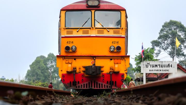
    Look past the pavilion and there's a second relic worth the walk: locomotive No. 305, a 2-8-2 Baldwin-built steam engine dating to 1925, parked on a short spur beside the platform. It's a working reminder that this station was, for most of the 20th century, a functioning link in the line to Malaysia, not a museum piece. The State Railway of Thailand kept both buildings largely intact even through a 2023 reconstruction tied to the Southern Line's double-tracking project, which widened the platforms without erasing the original facades.

    Recognition

    In 1982 the station received an Association of Siamese Architects conservation award, and it has since been named by the BBC among the world's most remarkable railway stations — rare company for a building that still runs scheduled trains.

    Visiting today

    The station sits on Damnoen Kasem Road, an easy 10–15 minute walk from Hua Hin's main beach and close enough to the night market and Chatchai Market to fold into an evening stroll. It's a working station, open around the clock, and free to enter — you only pay if you're boarding a train. Most visitors spend 20 to 30 minutes photographing the pavilion and the platform before moving on, though train enthusiasts linger longer. Go in late afternoon, when the low sun catches the ochre paintwork and the crowds thin.

    Sources

  • Travel

    A rocky headland south of Hua Hin beach, Khao Takiab pairs a 20-metre golden Buddha and a working fishing pier with hundreds of bold long-tailed macaques — hence its nickname, Monkey Mountain.

    3 min read

    Hua Hin: Khao Takiab, temple hill and coastline

    Travel

    Hua Hin: Khao Takiab, temple hill and coastline

    Last reviewed: 16 July 2026 Written by Ricardo Santos

    Da Na / Pexels

    A rocky headland south of Hua Hin beach, Khao Takiab pairs a 20-metre golden Buddha and a working fishing pier with hundreds of bold long-tailed macaques — hence its nickname, Monkey Mountain.

    Chopsticks Hill

    Khao Takiab — "Chopsticks Hill" — is the rocky headland that closes off the southern end of Hua Hin beach, about 7 km from the town centre, where it separates Hua Hin from the quieter sands of Khao Tao. The hill rises somewhere around 270 metres depending on which survey you trust (sources genuinely disagree, anywhere from 77 to 272 metres depending on what's being measured), and its outline is visible from most of Hua Hin's beachfront hotels, especially at sunset when it turns violet against the Gulf of Thailand.

    The temple and the golden Buddha

    At the summit sits Wat Khao Takiab, a Thai-Chinese temple whose grounds cover roughly 152 rai (about 24 hectares). It was formally established on 29 November 1985, though local tradition holds the site was sacred long before that, and it reportedly received a visit from Queen Rambhai Barni. The temple's defining feature is a standing golden Buddha, some 20 metres tall, facing out to sea — visible far enough offshore that fishermen have used it for generations as a navigational landmark, a point of reference to steer home by. Local fishing folklore goes further: the statue is said to hold back storms, both the literal kind that threaten boats and the metaphorical "storms of the heart."

    Monkey Mountain

    Wat Khao Takiab shares its hillside with a large population of long-tailed macaques — enough of them, fed regularly by temple visitors, that the hill is better known locally as "Monkey Mountain." They are markedly bolder than macaque troops elsewhere on the coast: expect them to go for water bottles, plastic bags, and anything that looks edible. Keep food out of sight, don't offer it by hand, and hold bags close — a grabbed phone or sunglasses is the most common complaint from visitors, not a bite.

    A working shoreline

    At the base of the hill, Khao Takiab village keeps a working fishing pier that predates Hua Hin's transformation into a royal resort — the area's association with the Thai crown actually goes back further than the beach hotels, to King Mongkut's 1868 eclipse expedition to nearby Wa Ko. Long-tail boats still land here, and the smell of diesel and drying fish is a useful reminder that this stretch of coast has an economy beyond tourism.

    Visiting

    Khao Takiab is reachable by songthaew from Phet Kasem Road (around 20 baht), by tuk-tuk or motorbike taxi (agree the fare first), or by scooter — allow around 15 minutes from central Hua Hin. Entry to the temple is free, though donations are welcomed; the site is open roughly 8:00 am to 5:00 pm. Cover shoulders and knees and remove your shoes before entering temple buildings. Budget one to two hours for the climb, the viewpoint, and the monkeys, and go early morning if you want calmer macaques and thinner crowds — or come back at dusk for one of the best sunset views on this stretch of coast.

    Sources

  • Travel

    No road reaches Railay: limestone cliffs, the hidden Phra Nang beach, a secret lagoon, and the climbing village of Tonsai, reachable only by longtail boat.
    3 min read

    Railay, Krabi: the roadless peninsula only a boat can reach

    Travel

    Railay, Krabi: the roadless peninsula only a boat can reach

    Last reviewed: 18 July 2026 Written by Ricardo Santos

    Photo by Una Baufala / Pexels

    No road reaches Railay: limestone cliffs, the hidden Phra Nang beach, a secret lagoon, and the climbing village of Tonsai, reachable only by longtail boat.
    A peninsula the road never reached

    No paved road connects to Railay: karst limestone cliffs drop straight into the Andaman Sea all around it, cutting this peninsula off from the rest of Krabi despite being only a few kilometres away as the crow flies. The only way in is a longtail boat from Ao Nang or Krabi Town, which naturally filters the flow of visitors and preserves a pace most Thai coastal destinations lost long ago.

    Getting there: boat logistics, not road logistics

    Longtails leave Ao Nang every 15-20 minutes during the day (about a 15-20 minute crossing) and land, depending on the tide, at either Railay East (mangrove side, permanent jetty) or Railay West (main beach, direct landing on sand). At low tide the boat sometimes stops short of the beach and you wade through shallow water — sandals and a dry bag for electronics are worth carrying. There is no regular night crossing: the last boat usually leaves before 6pm, which catches travellers used to late departures off guard.

    Railay West versus Railay East: two moods, one isthmus

    Railay West holds the region's best sunsets and most beachfront accommodation, with clear water good for swimming year-round. Railay East, a five-minute walk across the isthmus, has an unglamorous mangrove shoreline at low tide but concentrates the bars, budget restaurants, and most of the nightlife — the two sides complement rather than compete with each other.

    Phra Nang: the sacred beach that belongs to a shrine

    A fifteen-minute walk south of Railay West, Phra Nang beach holds a shrine to a legendary princess, where local fishermen still leave carved wooden phallic offerings — an old fertility and maritime-protection practice, worth observing respectfully and without intrusive photography. White sand and turquoise water framed by vertical rock walls make this Railay's most photographed beach; it's best seen early morning, before the organised tour boats arrive around 10am.

    The hidden lagoon and viewpoint few visitors reach

    A trail climbing from the far end of Railay East leads, via fixed ropes and improvised scrambling over wet rock, to a viewpoint overlooking the whole peninsula, then down into a brackish lagoon ringed by sheer walls — accessible only at low tide and inadvisable after rain, when the rock turns slick. The effort involved (30-45 minutes each way, demanding terrain, no railings) explains why only a minority of day-trippers attempt it, which makes it one of the few genuinely quiet corners left in Railay.

    Tonsai: the climbing village right next door

    A ten-minute walk or a very short boat hop from Railay West, Tonsai remains the epicentre of sport climbing in Thailand, with more than 700 bolted routes on the surrounding cliffs, climbable year-round for intermediate to advanced levels thanks to the region's compact limestone. The vibe is deliberately rougher — fewer upscale stays, more simple bungalows, and a population of long-stay climbers that gives Tonsai an identity distinct from beach-resort Railay.

    When to go, and how to keep the balance

    Dry season, November to April, brings the calmest sea and best climbing conditions; monsoon (May to October) brings heavier swell that can suspend boat crossings for hours, a real factor for any tight itinerary. As with most fragile Thai natural sites, favouring certified local climbing guides, never taking coral or shells, and respecting the quiet and posted hours around the Phra Nang shrine are what let Railay stay what it is: a peninsula the road never reached, and doesn't need to.

    Sources