
Travel
Chiang Mai: planning a responsible Doi Inthanon day
Last reviewed: 2026-07-16
Written by Ricardo Dos Santos
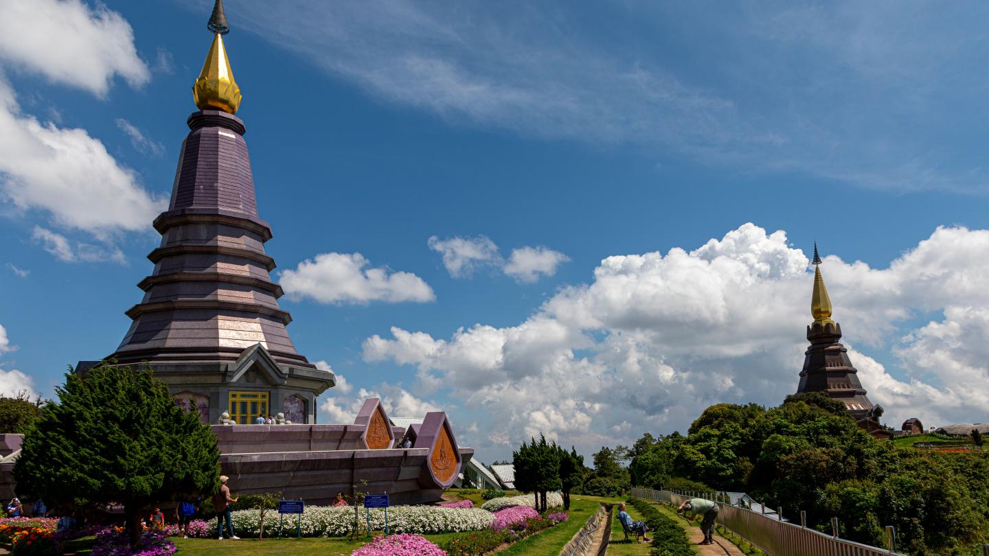
Thailand's highest peak is also, literally, a king's grave. A practical framework for visiting its summit, twin pagodas and closed-season trail without turning the mountain into a box to tick.
The mountain named after its own grave
At 2,565 metres, Doi Inthanon is mainland Thailand's highest point, but its modern name is a relatively recent tribute. It was once called Doi Luang Ang Ka, "crow's pond mountain," until it was renamed for King Inthawichayanon, Chiang Mai's seventh ruler, who reigned from 1870 to 1897 and pushed early forest-conservation policy for the region's northern highlands. British surveyor James McCarthy formalized the name "Inthanon" on official maps as tribute. What makes the story more than a naming footnote: after the king's death in 1897, his daughter, Princess Dara Rasmi, had his ashes interred in a small stupa near the true summit. The "Roof of Thailand" is, quite literally, also a royal tomb — most visitors who tick off the summit marker never learn they're standing beside a grave.
Twin pagodas with a different story entirely
A ridge lower down the mountain holds Phra Mahathat Naphamethanidon and Naphaphonphisai, two large pagodas built in 1987 and 1992 to mark the 60th birthdays of King Bhumibol and Queen Sirikit respectively. Unlike the centuries-old temples of Chiang Mai's Old City, these are modern royal monuments, and their setting is the point: a hanging garden walkway threads between them through cloud forest, with views that shift from bright sun to drifting mist within minutes depending on the hour. They read as a deliberate counterpoint to the summit's quiet grave — one site built to be seen, the other built to be found.
Why Kew Mae Pan needs a guide
The park's ecological centerpiece is the Kew Mae Pan nature trail, a loop through high-altitude cloud forest and grassland considered one of the most sensitive habitats in the park. It closes entirely from June through October each year to let the ecosystem recover from dry-season foot traffic, and even in open months a local guide is mandatory — arranged on-site for roughly 200-220 THB per group, not optional or skippable. The rule exists because the trail's soil and rare montane plant species erode quickly under unsupervised, off-boardwalk traffic; staying on the marked path isn't a suggestion here.
Weather that changes the plan
Doi Inthanon runs cool to genuinely cold year-round by Thai standards, and fog rolls through the upper elevations often enough that a hazy or socked-in summit is a real possibility, not a rare fluke. Bring layers regardless of season — a T-shirt-weather morning in Chiang Mai can mean a jacket-and-scarf afternoon at the peak. There's no temple-strict dress code at the pagodas, but modest clothing is customary and appreciated.
Practical planning
Entry costs 300 THB for foreign adults, 150 THB for children, plus a small 20-30 THB vehicle fee. From Chiang Mai, the route runs via Highway 107 to Chom Thong, then Highway 1009 for roughly 48 km up to the summit area; budget travelers can catch a songthaew from Chom Thong or Mae Klang Waterfall for around 20 THB, though a private driver or organized tour is more practical for covering the whole park in one day. Treat this as a full-day outing — six to eight hours — rather than a summit-and-leave dash: the twin pagodas, at least one waterfall (Mae Ya or Wachirathan are the standouts), and the Kew Mae Pan trail if it's open all deserve unhurried time, and rushing the mountain misses the point of what makes it worth the drive.
Source: Tourism Authority of Thailand, tourismthailand.org