Safety
GISTDA Issues Flood Alerts Across Central and Northeastern Thailand
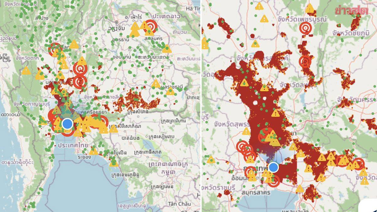
Satellite data from GISTDA indicates high-risk flooding in multiple provinces following persistent heavy rainfall.
On September 25, 2026, the Geo-Informatics and Space Technology Development Agency (GISTDA) released satellite imagery and geospatial analysis warning of significant flood risks across Thailand. Using their 'Check Nam' application, the agency identified high-risk 'red zone' areas experiencing severe water accumulation due to continuous heavy rain.
In the Central region and lower Northern provinces, satellite analysis shows an expanding high-risk area covering Nakhon Sawan, Phichit, Phetchabun, Lopburi, Saraburi, Suphan Buri, Pathum Thani, Nonthaburi, and parts of Bangkok. Additionally, the agency reported hazardous water accumulation on several major road networks, which may impact travel and logistics. In the lower Northeastern region, provinces including Surin, Si Sa Ket, Buri Ram, and Roi Et are facing widespread flooding in low-lying areas and agricultural zones, directly affecting local residents.
For residents and travelers, these alerts suggest potential disruptions to road travel and local infrastructure. It is advised to monitor official updates and exercise caution when navigating areas identified as high-risk. While GISTDA provides real-time monitoring, the full extent of the impact on specific local transport routes and the duration of the floodwaters remain to be confirmed by local authorities. Travelers are encouraged to check local conditions before planning trips through these affected provinces.