Safety
GISTDA Warns of High Flood Risks Across Thailand
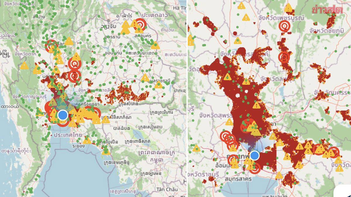
Thailand's space agency has identified widespread high-risk flood zones following persistent heavy rainfall, urging residents to remain vigilant.
On September 25, 2026, the Geo-Informatics and Space Technology Development Agency (GISTDA) released satellite imagery highlighting significant flood risks across multiple Thai provinces. According to Khaosod English, the agency is utilizing advanced satellite technology and geospatial data to track the impact of ongoing heavy rainfall throughout the country.
For residents and travelers, this development is critical as it indicates a heightened potential for sudden flooding in specific regions. GISTDA has specifically advised those located in areas designated as 'red zones' to monitor the situation closely and stay informed through official channels.
While the satellite data provides a clear overview of the current high-risk areas, the full extent of the potential impact remains to be confirmed as weather conditions evolve. Travelers planning trips to affected provinces should exercise caution, check local weather reports frequently, and follow guidance from provincial authorities. As of now, the agency continues to process geospatial data to provide updated assessments. It is recommended that those in vulnerable areas prepare for potential disruptions to travel and daily activities, though specific evacuation orders or localized damage reports are subject to ongoing monitoring by local government agencies.