
Safety
GISTDA Satellite Data Indicates Heavy Rainfall Across Northern, Northeastern, and Central Thailand
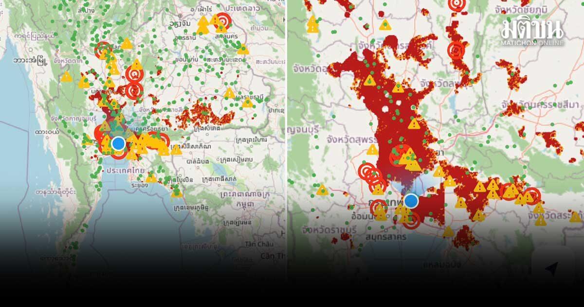
Thailand's space agency has released satellite imagery showing significant cumulative rainfall, raising concerns about potential flooding in several regions including Bangkok.
On September 25, 2026, the Geo-Informatics and Space Technology Development Agency (GISTDA) released satellite data highlighting areas of Thailand experiencing heavy cumulative rainfall. According to the report from Matichon Online, the data indicates that the Northern, Northeastern, and Central regions are currently facing significant precipitation levels.
For residents and travelers, this weather pattern is particularly concerning as it increases the risk of flash floods and water accumulation in low-lying areas. The agency specifically noted that Bangkok is among the areas at risk of potential flooding due to the ongoing weather conditions.
This information is vital for those planning travel or residing in these regions, as heavy rain can lead to sudden disruptions in local transport and infrastructure. While the satellite imagery confirms the extent of the rainfall, the specific impact on individual neighborhoods or the duration of the flood risk remains to be confirmed by local authorities. Residents and visitors are advised to monitor official updates from the Thai Meteorological Department and local disaster prevention offices for real-time warnings and safety instructions. It is recommended to exercise caution when traveling through areas prone to waterlogging and to stay informed about changing conditions in the coming days.